For most of our research projects, the ultimate goal is a working system or at least prototype. Click on any of the screenshots below to get to the corresponing demo. If one of the demos does not work, or you have questions about it, please drop us a line at bast@cs.uni-freiburg.de .
Semantic Full-Text Search
 |
|
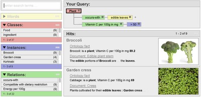
Semantic Full-Text Search provides a deep integration of classical keyword search in text documents with structured search in knowledge databases aka triples stores. Our current demo works on a combination of the English Wikipedia (around 300 million sentences) with the complete Freebase ontology (around 300 million general facts). Click on the screenshot for more information or to just play around with our demo. |
Freebase Easy Search
 |
|
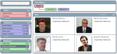
This demo provides an easy access to the very large and complex Freebase knowledge base. Click on the screenshot for more information or to just play around with the demo. Just start by typing a few letters in the search field, and the UI will provide you with various suggestions for how to construct / extend your query from that. |
The Icecite Research Paper Management System
 |
|
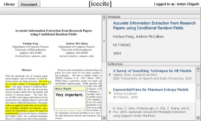
Icecite is a research paper management system with the following unique feature set:
- Automatic extraction of metadata AND references from PDFs
- On-click download of new papers (e.g. from the reference section)
- Collaborative annotations
- Offline availability
- Full-featured search
|
CSD-IE
 |
|
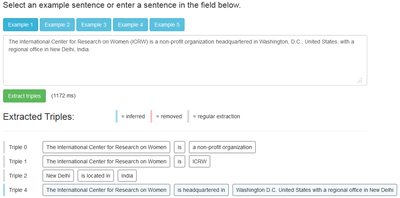
CSD-IE is an open information extraction system that is based on contextual sentence decomposition (CSD), a technique originally developed for our high precision semantic search. The system extracts triples (subject, predicate, object) from natural language text input at high precision and recall. |
Travic: World-Wide Public Transit Visualization
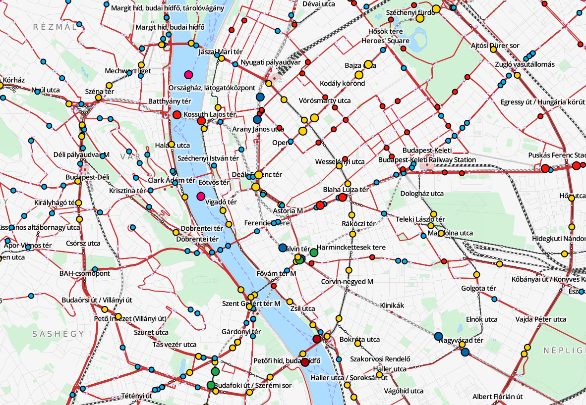 |
|
TRAVIC visualizes live public transit movements in currently over 200 areas all over the world. The server reads static GTFS schedules, combines the data with realtime feeds and outputs the (approximate) position of every public transit vehicle currently moving through the area. |
LOOM: Line-Ordering Optimized Transit Maps
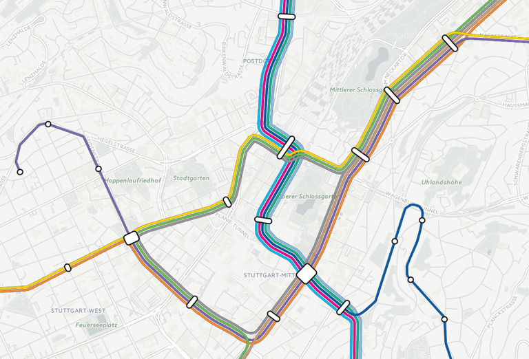
|
|
LOOM automatically renders geographically correct public transit maps. It builds a transit line graph from GTFS feeds, globally optimizes the line ordering using integer linear programming and outputs ready-to-use vector graphics that can, for example, be used as a map overlay. |
octi: Fast Octilinear Transit Maps
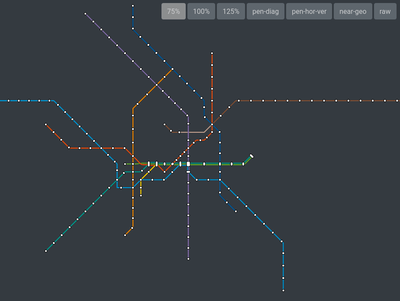 |
|
octi renders input line graphs in an octilinear fashion using an approximation approach based on iterative shortest-path calculations on a special grid graph. Octilinearization usually takes less than a second, even for complex input graphs. |
staty: Automatic Quality Assurance for Public Transit Stations in
OpenStreetMap
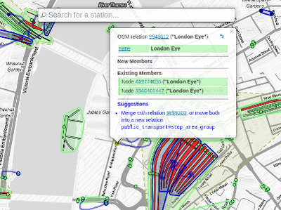
|
|
staty analyzes public transport station in OpenStreetMap for correctness and gives both possible attribute errors and suggestions on an interactive map. |
TODO: Screenshot + short description for remaining demos
http://www.dblp.org ... CompleteSearch DBLP = full-features search in the DBLP literature database
http://www.homeonet.org ... HomeoNet = interactive simulation of user-defined regulatory circuits
http://anthro.cs.uni-freiburg.de ... Anthro = visualization of the ANSUR anthropometric dataset
http://forestmaps.cs.uni-freiburg.de ... ForestMaps = forest usage heat maps
http://panarea.informatik.uni-freiburg.de/routeplanner ... MultiModal = multi-modal route planning